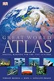
Great world atlas.
Material type: MapPublication details: London ; New York : D.K., (c)2008.Edition: fifth American editionDescription: 1 atlas (xxxvi, 491 pages) : color illustrations, color maps (some folded) ; 46 cmContent type:
 - cartographic image
- unmediated
- volume
- 9780756639846
- G1021 .G743 2008
- G1021
- COPYRIGHT NOT covered - Click this link to request copyright permission:
| Item type | Current library | Collection | Call number | Status | Date due | Barcode | |
|---|---|---|---|---|---|---|---|
| Withdrawn | G. Allen Fleece Library WITHDRAWN | RES | G1021 .D6719 2008-A3 (Browse shelf(Opens below)) | 1 Not for loan | 31923001840426 |
"Copyright ... Dorling Kindersley Limited, London"--T.p. verso.
Also shows remote-sensing maps of the earth using satellite imagery.
Issued in slip case.
Relief shown by shading, gradient tints, and spot heights. Depths shown by gradient tints.
The world -- North America -- South America -- Africa -- Europe -- Asia -- Australia and Oceania.
Provides maps and geographic, political, and economic information on every world region, presenting more than 750 photographs and 1,500 illustrations, including digital maps and satellite images, and contains several gatefold maps and an index-gazetteer.
COPYRIGHT NOT covered - Click this link to request copyright permission:
There are no comments on this title.
